Datei:15th century map of Turkey region.jpg
Zur Navigation springen
Zur Suche springen
Größe dieser Vorschau: 800 × 600 Pixel. Weitere Auflösungen: 320 × 240 Pixel | 640 × 480 Pixel | 1.024 × 768 Pixel | 1.280 × 960 Pixel | 2.048 × 1.536 Pixel
Originaldatei (2.048 × 1.536 Pixel, Dateigröße: 884 KB, MIME-Typ: image/jpeg)
![]()
Diese Datei und die Informationen unter dem roten Trennstrich werden aus dem zentralen Medienarchiv Wikimedia Commons eingebunden.
![]()
| Beschreibung |
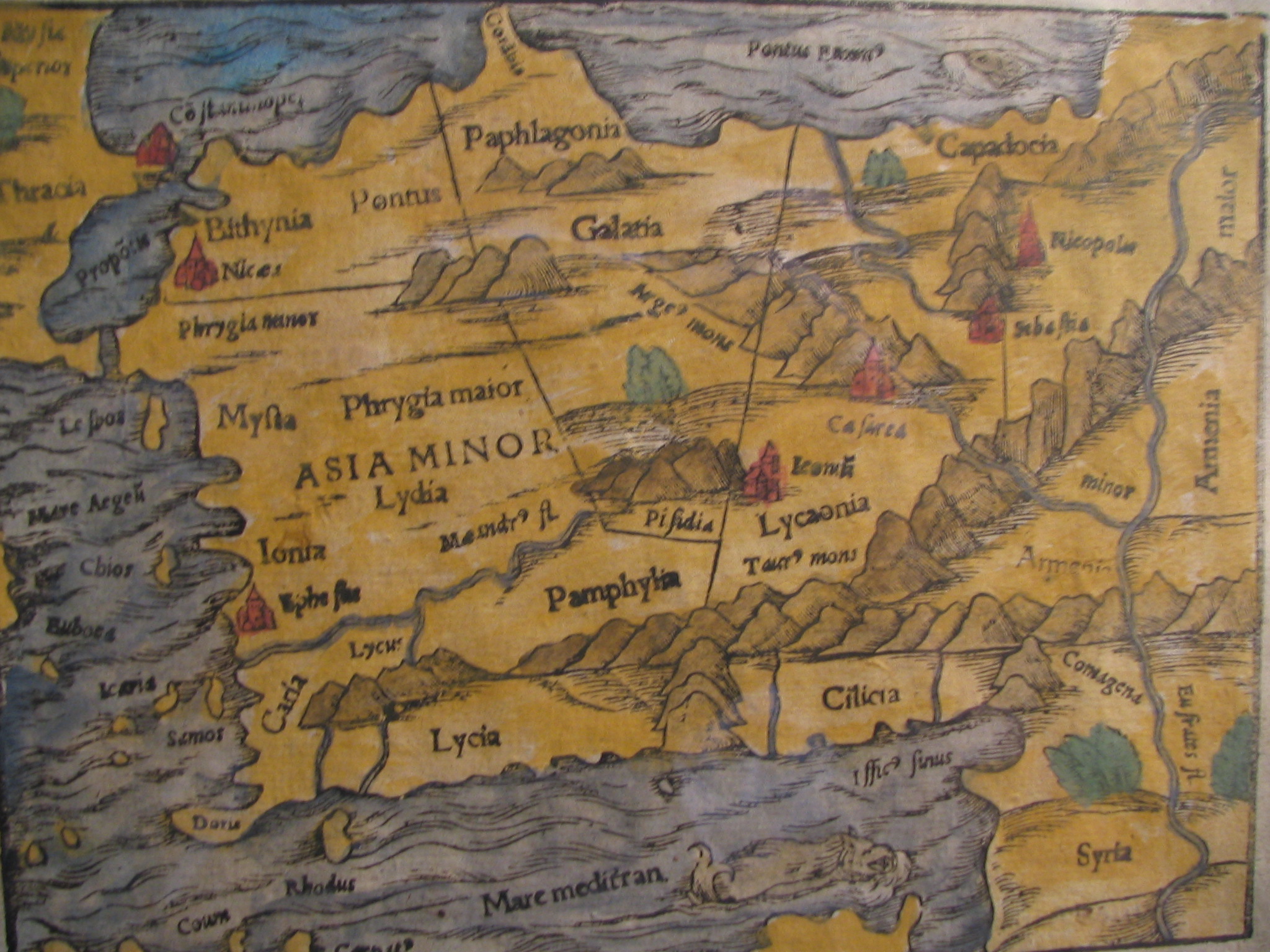
English: Picture of a map of the region of what is now Turkey from the 15th Century. I own this map, having purchased it, and have all official documentation regarding its authenticity. |
||||
| Datum | 15. Jahrhundert, Digitized on: 10. Dezember 2006, 19:42:23 | ||||
| Quelle |
|
||||
| Urheber | Autor/-in unbekannt, Photographer: Electionworld | ||||
| Genehmigung (Weiternutzung dieser Datei) |
Diese Datei ist unter der Creative-Commons-Lizenz „Namensnennung – Weitergabe unter gleichen Bedingungen 2.5 generisch“ (US-amerikanisch) lizenziert.
|
||||

Dateiversionen
Klicke auf einen Zeitpunkt, um diese Version zu laden.
| Version vom | Vorschaubild | Maße | Benutzer | Kommentar | |
|---|---|---|---|---|---|
| aktuell | 16:04, 21. Feb. 2018 | | 2.048 × 1.536 (884 KB) | Ket | Reverted to version as of 09:40, 17 December 2006 (UTC) |
| 16:03, 21. Feb. 2018 |  | 2.048 × 1.536 (921 KB) | Ket | better contrast | |
| 11:40, 17. Dez. 2006 |  | 2.048 × 1.536 (884 KB) | Electionworld | {{ew|en|Rarelibra}} == Summary == Picture of a map of the region of what is now Turkey from the 15th Century. I own this map, having purchased it, and have all official documentation regarding its authenticity. == Licensing == {{cc-by-sa-2.5}} |
Dateiverwendung
Die folgende Seite verwendet diese Datei:
Globale Dateiverwendung
Die nachfolgenden anderen Wikis verwenden diese Datei:
- Verwendung auf ar.wikipedia.org
- Verwendung auf ast.wikipedia.org
- Verwendung auf bg.wikipedia.org
- Verwendung auf ca.wikipedia.org
- Verwendung auf cs.wikipedia.org
- Verwendung auf da.wikipedia.org
- Verwendung auf el.wikipedia.org
- Verwendung auf en.wikipedia.org
- Verwendung auf eo.wikipedia.org
- Verwendung auf es.wikipedia.org
- Verwendung auf eu.wikipedia.org
- Verwendung auf fr.wikipedia.org
- Verwendung auf gl.wikipedia.org
- Verwendung auf hr.wikipedia.org
Weitere globale Verwendungen dieser Datei anschauen.